Awakino Gorge flooding leaves one lane open on SH3: what travellers should know
Heavy rain has put State Highway 3 through Awakino Gorge under stop/go control. NZTA says one lane is open and motorists should expect delays.
Verified brief
The story in 60 seconds
NZTA said one lane of SH3 through Awakino Gorge was open under stop/go traffic management on 15 October after flooding affected the other. The status can change; check the agency’s live Journey Planner before travelling and follow crews on site.
This brief and the full story below are based on the disclosed sources. SearchTrends Daily’s interpretation appears later under “Our take.”
Full reporting
The complete story
One lane of State Highway 3 through Awakino Gorge was open under stop/go control on Thursday 15 October after heavy rain and flooding affected the route, NZ Transport Agency Waka Kotahi said in an 11:51am bulletin. Water was affecting one lane. The agency told drivers to expect delays, obey traffic management and instructions from staff, and drive for the conditions. That bulletin is a time-stamped update, not a guarantee that the same lane arrangement will remain in place all day. RNZ reported the one-lane restriction at 1:45pm, citing the transport agency, and said a cold front was moving across the North Island. Neither report gave a confirmed reopening time for both lanes or an estimate for when the water would recede. Drivers should use NZTA’s live Journey Planner shortly before departure and again if conditions change en route. A person already approaching the site should follow the signs and onsite staff rather than rely on an earlier article or map screenshot.
Source perspectives
What other reporting adds
These are the reports, official records, and trend observations used to build the story. The note under each link explains exactly what it contributes.
Primary time-stamped road bulletin confirming one lane open, stop/go control and expected delays.
Read original source ↗RNZHeavy rain causes flooding in Awakino GorgeIndependent 15 October report confirming one-lane status and wider rain context.
Read original source ↗NZ Transport Agency Waka KotahiSH3 through Awakino Gorge reopening at midday, June 2026Historical context on route controls and NZTA safety monitoring; not the October flood cause.
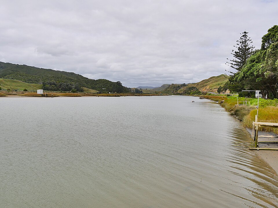
Read original source ↗Wikimedia CommonsAwakino River, view to south-east, 2017, by Ulrich LangeSource and creator of archival hero; view near village, not October flood or affected highway.
Read original source ↗Creative CommonsCreative Commons Attribution-ShareAlike 4.0Image reuse license for Ulrich Lange archival Awakino River photograph.
Read original source ↗SearchTrends Daily opinion
Our take
Analysis
What the evidence and search signal suggest
Our analysis: the agency’s wording matters. “One lane open” means a route remains passable under control at the time of its bulletin, while the absence of an all-clear time means travel plans need a fresh check. The separate June safety bulletin shows why a driver should expect access rules in this gorge to respond to conditions; it does not establish that the October flood has caused a slip.
Analysis and commentary are SearchTrends Daily’s interpretation. They are intentionally separated from the sourced account above.
Meaning
Why this matters
SH3 is a key route through this part of the North Island. Even with a lane open, alternating traffic means queues can build, especially if rain continues or crews need to change the traffic setup. For people with timed appointments, freight schedules or long trips, the practical distinction is between a controlled passage and a fully unrestricted road. The safe planning assumption is extra time, not a fixed delay estimate the agency has not supplied.
Background
How we got here
Awakino Gorge has required active traffic controls before. In a separate June 2026 bulletin, NZTA said SH3 reopened under stop/go after land movement above the road, and described a safety plan that uses rain, wind, ground conditions and inspections to decide when access must change. That June event is background about the route, not the cause of the October flooding. The present restriction is attributed by NZTA to heavy rain and floodwater affecting one lane. Photo credit: an archival 2017 view of the Awakino River from the village by Ulrich Lange, via Wikimedia Commons, CC BY-SA 4.0. It does not show the October flood or the affected section of SH3.
Outlook
What is likely to happen next
NZTA may ease or tighten stop/go controls as water levels and conditions change. No timing for a return to two-way unrestricted travel was given in the bulletin reviewed. We will update this story if the agency publishes a material change. For immediate travel decisions, use its live Journey Planner and any instructions from crews at the road.
A conditional editorial assessment based on the evidence available at the review date, not a guaranteed outcome.
Live record
Updates to this story
No material updates yet.


Commentary
What we think
SearchTrends Daily opinion: a short public road bulletin is most useful when it states exactly what is open, what is controlled and where travellers can get the next update. The NZTA notice does that. Drivers should treat a search trend or social post as a prompt to check the official Journey Planner, because a route can change faster than a news page can be refreshed.